Integrated Monitoring of Ice in selected Swiss Lakes
The final project report is available here.
Motivation:
Various lake observables are related to climate and climate change and provide a good opportunity for long-term monitoring, among them the duration and extent of lake ice, as part of the Essential Climate Variables (ECVs). This is recognized in the Status of the Global Observing System for Climate (task T10). In 2007, MeteoSwiss published the first national inventory of the most important climate observations in Switzerland, including observations of lake ice as part of the essential climate variable “Lakes”. This was also reflected in a decision of the Swiss Federal Government in 2008, which gave MeteoSwiss the mandate to ensure the continuation of the most important climate measurements series in Switzerland. In the global NSIDC (National Snow and Ice Data Center, Boulder, Colorado) database on lake ice on/off dates, currently only Lake St. Moritz is partly included (till 2012). There exist already observations and data from local authorities/publications etc., however they are not systematic and come from different, uncoordinated and not secured sources. Traditionally, on-shore observers collected the information of lake ice recording the visible ice-edge. Within the past two decades due to lack of budget and/or human resources, the number of field stations declined. The potential of different remote sensing sensors covering varying time periods and spatial coverage to measure the occurrence of lake ice was demonstrated by several investigations. Thus, MeteoSwiss initiated this project for an integrated multi-temporal monitoring of lake ice, using not only satellite images but also exploring the possibilities of WEBCAMs and in-situ measurements.
Aims:
The project aim is to monitor some target lakes and detect the extent of ice, the duration of lake ice and in particular the ice on/off dates., with focus on the integration of various input data and processing methods. Thereby, various approaches will be implemented, developed, compared and integrated. Firstly, low spatial resolution (250 - 1000 m) but high temporal resolution (1 day) satellite images from various sensors will be used. Several spectral channels will be used, both reflective and emissive (thermal). Secondly, and as a pilot project, the use of existing WEBCAMs will be investigated for (a) validation of results from satellite data, and (b) independent estimation of lake ice, especially for small lakes that cannot be detected in the satellite images. Thirdly, in-situ measurements will be made in order to characterize the development of the temperature profiles before freezing and under the ice-cover until thawing. Besides the validation of the results from other data, this data will be used to calibrate a one-dimensional turbulence model so that the criteria for freezing of different Swiss lakes can be derived as a function of the meteorological conditions in late autumn and winter. It is expected that the developed methods and software can be used, possibly with some modifications, also for data acquired in the future. The project is a feasibility study, which should lead to a comparison and analysis of the above three techniques and recommendations to MeteoSwiss for further actions.
Input data:
Satellite images (multispectral, temporal resolution of 1 day, spatial resolution at best 250m pixel size): MODIS, VIIRS
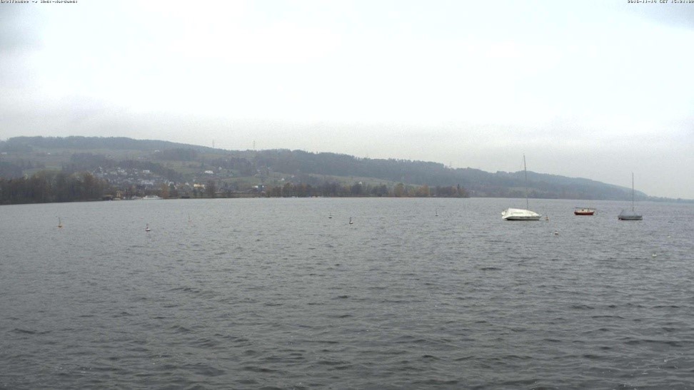
WEBCAM images: publicly available images (for validation and as a pilot project on possible usage of better WEBCAM images for lake ice detection)
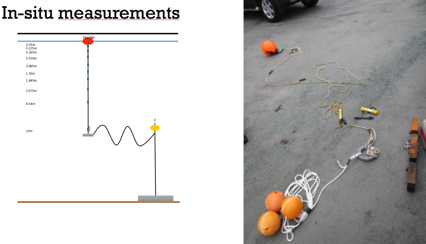
In-situ measurements: temperature measurements in lakes. Modelling of freezing processes.
Satellite images with higher spatial resolution for validation: Landsat, Sentinel-2, Aster
Other validation data: human observations, media reports, etc.
Target lakes:
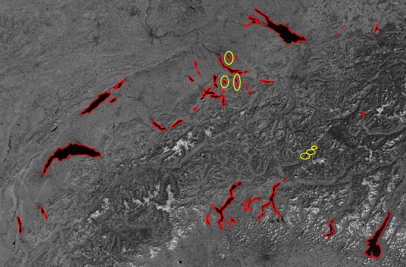
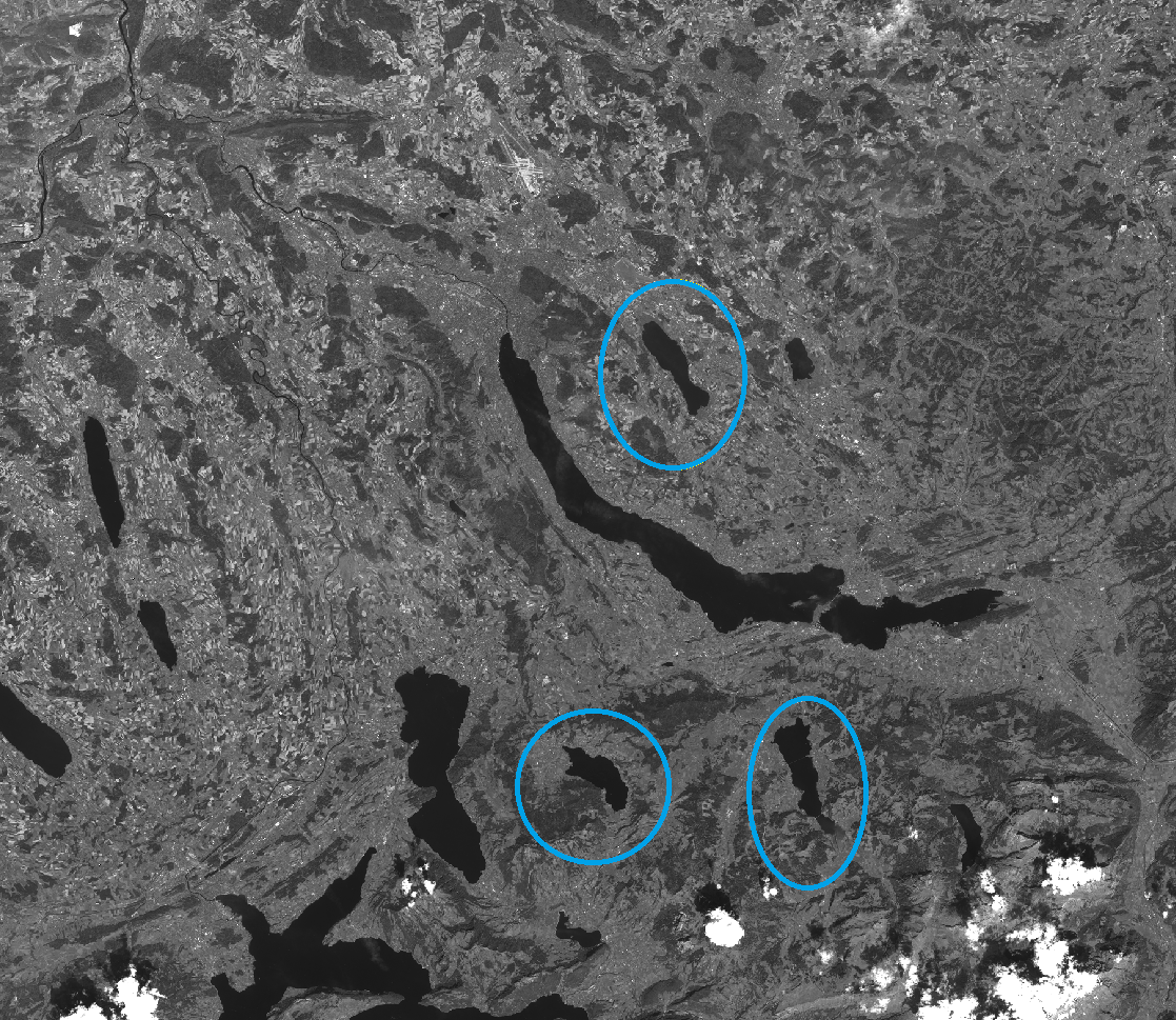
They include (in decreasing area from about 11 to 1 km2): Sihlsee, Greinfensee, Aegerisee, Silsersee, Silvaplanersee, St. Moritzersee. These lakes have variable area (very small to middle-sized), altitude (low to high) and surrounding topography (flat/hilly to mountainous) and freeze often, covering thus difficult to medium difficulty cases, regarding area, altitude and topography. Hence, we expect that if the project is successful, its results could be applicable to other similar or easier lake conditions in Switzerland and abroad. The known, digitised lake outlines will be projected in the images to guide the search and estimation of lake ice.
Financed by:
Swiss Federal Government via MeteoSwiss (GCOS Switzerland)
Duration:
Summer 2016 – Autumn 2018
Project Partners:
Federal Office of Meteorology and Climatology MeteoSwiss (external page http://www.gcos.ch)
ETH Zurich (project coordination)
University of Bern (external page project page)
EAWAG (external page project page)
Publications:
Xiao M., Rothermel M., Tom M., Galliani S., Baltsavias E., Schindler K.: Lake Ice Monitoring with Webcams (PDF, 3.8 MB), ISPRS Annals of the Photogrammetry, Remote Sensing and Spatial Information Sciences, IV-2, pages 311-317, 2018
Tom M., Kälin U., Sütterlin M., Baltsavias E., Schindler K.: Lake Ice Detection in Low-Resolution Optical Satellite Images (PDF, 1.7 MB), ISPRS Annals of the Photogrammetry, Remote Sensing and Spatial Information Sciences, IV-2, pages 279-286, 2018
Rothermel M., Xiao M., Tom M., Baltsavias E., Schindler K.: Monitoring der Vereisung von Schweizer Seen mit Webcams (PDF, 919 KB), Geomatik Schweiz 9/2018, S. 268-271
Tom M., Sütterlin M., Bouffard D., Rothermel M., Hamann U., Duguay-Tetzlaff A., Wunderle S., Baltsavias E.: Integrated Lake Ice Monitoring in Swiss Lakes (PDF, 504 KB), EUMETSAT 2018 - Meteorological Satellite Conference, Tallinn, Estonia, 2018
Tom M., Lanaras C., Baltsavias E., Schindler K.: Ice Detection in Swiss Lakes using MODIS Data (PDF, 2.3 MB), 38th Asian Conference on Remote Sensing, New Delhi, India, 2017